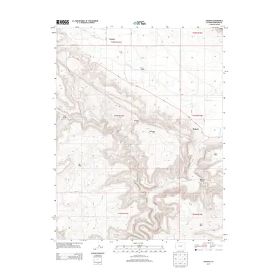
2013 Map of Paradox
USGS Topo · Published 2013About this map
Paradox Valley forms the central character of this Western Colorado landscape, where the town of Paradox and the nearby Paradox Cem are situated within a unique geological depression. To the southeast, the Dolores River cuts through the high desert terrain, passing the settlement of Bedrock and the winding depths of Wild Steer Canyon. This survey captures a topography defined by significant mesa formations, including Davis Mesa, Ray Mesa, and Nyswonger Mesa, which rise sharply above the valley floor. The placement of the namesake community in the valley—so named because the river runs perpendicular to it rather than through it—remains a defining feature of the local geography. Notable landmarks such as Aperture Arch and the drainage of La Sal Cr highlight the erosional patterns of the Uncompahgre Plateau region during the early 21st century.
Find a feature on this map
31 named features on this map. Tap any name to fly to it.
Don’t see what you’re looking for? This feature index may not catch every label — zoom into the map to look around manually.
Map Details
Editions of this 2013 Paradox Map
This is the sole edition of this map. No revisions or reprints were ever made.
Other maps of this area

1885 · La Sal
USGS Topo · 1:250,000

1916 · Paradox Valley
USGS Topo · 1:125,000

1922 · Paradox Valley
USGS Topo · 1:125,000

1948 · Roc Creek
USGS Topo · 1:24,000

1948 · Bull Canyon
USGS Topo · 1:24,000

1948 · Paradox
USGS Topo · 1:24,000

1949 · Bull Canyon
USGS Topo · 1:24,000

1949 · Davis Mesa
USGS Topo · 1:24,000

1949 · Paradox
USGS Topo · 1:24,000

1949 · Roc Creek
USGS Topo · 1:24,000