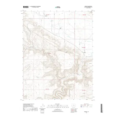
2019 Map of Paradox
USGS Topo · Published 2019About this map
The Paradox Valley floor and the surrounding high mesas of western Montrose County define this 2019 survey. The small settlement of Paradox sits at the northern end of the valley, while Bedrock is located to the southeast where the Dolores River cuts across the geological grain of the land. This unusual drainage pattern, where the river flows perpendicular to the valley rather than through it, is the source of the area's name.
Find a feature on this map
38 named features on this map. Tap any name to fly to it.
Don’t see what you’re looking for? This feature index may not catch every label — zoom into the map to look around manually.
Map Details
Editions of this 2019 Paradox Map
This is the sole edition of this map. No revisions or reprints were ever made.
Other maps of this area

1885 · La Sal
USGS Topo · 1:250,000

1916 · Paradox Valley
USGS Topo · 1:125,000

1922 · Paradox Valley
USGS Topo · 1:125,000

1948 · Roc Creek
USGS Topo · 1:24,000

1948 · Bull Canyon
USGS Topo · 1:24,000

1948 · Paradox
USGS Topo · 1:24,000

1949 · Bull Canyon
USGS Topo · 1:24,000

1949 · Davis Mesa
USGS Topo · 1:24,000

1949 · Paradox
USGS Topo · 1:24,000

1949 · Roc Creek
USGS Topo · 1:24,000