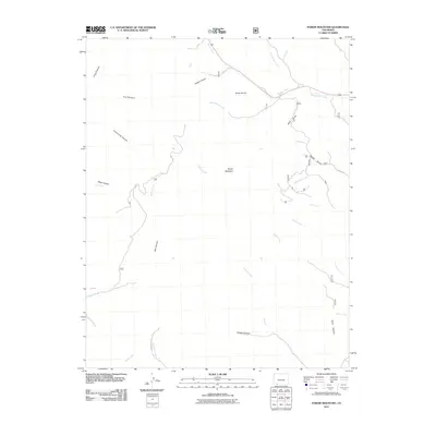
2011 Map of Pargin Mountain
USGS Topo · Published 2011About this map
Pargin Mountain dominates this portion of La Plata County, serving as a central hub for a complex network of canyons and drainage systems. This 2011 survey by the U. S. Geological Survey details the intricate topographical relief of the region, where numerous waterways like Ignacio Creek, Turkey Creek, and Goose Creek have carved deep paths through the landscape. The map highlights the rugged isolation of southwestern Colorado, tracing routes such as Co RD 335 and County Rd M30 that skirt the edges of significant geological formations. To the west, the deep incisions of Ritter Canyon and Armstrong Canyon indicate the erosion-driven character of the terrain, while the eastern reaches are defined by numerous gulches, including Fosset Gulch and Wagon Gulch, illustrating the area's diverse geological history and drainage patterns.
Find a feature on this map
27 named features on this map. Tap any name to fly to it.
Don’t see what you’re looking for? This feature index may not catch every label — zoom into the map to look around manually.
Map Details
Editions of this 2011 Pargin Mountain Map
This is the sole edition of this map. No revisions or reprints were ever made.
Other maps of this area

1908 · Ignacio
USGS Topo · 1:125,000

1924 · Ignacio
USGS Topo · 1:125,000

1924 · Pagosa Springs
USGS Topo · 1:125,000

1927 · Pagosa Springs
USGS Topo · 1:125,000

1945 · Durango
USGS Topo · 1:250,000

1953 · Durango
USGS Topo · 1:250,000

1954 · Durango
USGS Topo · 1:250,000

1954 · Allison
USGS Topo · 1:24,000

1954 · Carracas
USGS Topo · 1:24,000

1961 · Durango
USGS Topo · 1:250,000