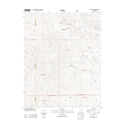
2013 Map of Pargin Mountain
USGS Topo · Published 2013About this map
Pargin Mountain dominates the central landscape of this 2013 survey, situated within the expansive San Juan National Forest. The map documents the complex topography of the La Plata and Archuleta county line, defined by a series of deep canyons and gulches including Armstrong Canyon, Fosset Gulch, and Ritter Canyon. These natural features dictate the path of historical routes such as the Pine Piedra Trail 524 and the Bull Creek Trail 682, which navigate the high-elevation terrain. A network of drainages, notably Ignacio Cr and Yellowjacket Cr, flow through the wilderness area, illustrating the watershed patterns before they meet the major highways. Modern transit is represented by US Hwy 160, which cuts through the northern sections, providing a clear contrast between developed infrastructure and the remote interior of the forest.
Find a feature on this map
38 named features on this map. Tap any name to fly to it.
Don’t see what you’re looking for? This feature index may not catch every label — zoom into the map to look around manually.
Map Details
Editions of this 2013 Pargin Mountain Map
This is the sole edition of this map. No revisions or reprints were ever made.
Other maps of this area

1908 · Ignacio
USGS Topo · 1:125,000

1924 · Ignacio
USGS Topo · 1:125,000

1924 · Pagosa Springs
USGS Topo · 1:125,000

1927 · Pagosa Springs
USGS Topo · 1:125,000

1945 · Durango
USGS Topo · 1:250,000

1953 · Durango
USGS Topo · 1:250,000

1954 · Durango
USGS Topo · 1:250,000

1954 · Allison
USGS Topo · 1:24,000

1954 · Carracas
USGS Topo · 1:24,000

1961 · Durango
USGS Topo · 1:250,000