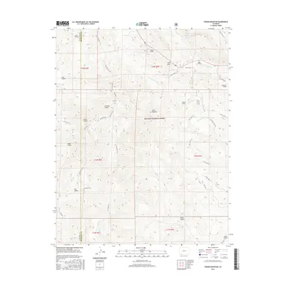
2016 Map of Pargin Mountain
USGS Topo · Published 2016About this map
Pargin Mountain dominates the central landscape of this Colorado survey, serving as a prominent landmark within the San Juan National Forest. The map documents a rugged system of drainages and canyons, including the family-named Armstrong Canyon and Zabel Canyon in the west, while Fosset Gulch and Peterson Gulch define the northern slopes. The area is intersected by several primitive routes, most notably the Pine Piedra Trail, which winds through the townships alongside the Ute Creek Trail and Bull Creek Trail. These trails follow the natural contours of the land, providing access to remote features like Salt Canyon and Skull Canyon. This 2016 edition illustrates the persistent topography of the La Plata and Archuleta county line, where complex hydrography like Ignacio Creek and Yellowjacket Creek carve through the high-elevation terrain.
Find a feature on this map
36 named features on this map. Tap any name to fly to it.
Don’t see what you’re looking for? This feature index may not catch every label — zoom into the map to look around manually.
Map Details
Editions of this 2016 Pargin Mountain Map
This is the sole edition of this map. No revisions or reprints were ever made.
Other maps of this area

1908 · Ignacio
USGS Topo · 1:125,000

1924 · Ignacio
USGS Topo · 1:125,000

1924 · Pagosa Springs
USGS Topo · 1:125,000

1927 · Pagosa Springs
USGS Topo · 1:125,000

1945 · Durango
USGS Topo · 1:250,000

1953 · Durango
USGS Topo · 1:250,000

1954 · Durango
USGS Topo · 1:250,000

1954 · Allison
USGS Topo · 1:24,000

1954 · Carracas
USGS Topo · 1:24,000

1961 · Durango
USGS Topo · 1:250,000