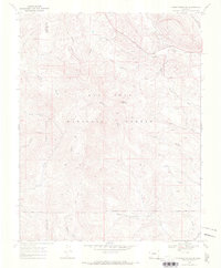
1968 Map of Pargin Mountain
USGS Topo · Published 1972About this map
Pargin Mountain anchors this 1968 survey of the high country along the border of La Plata and Archuleta counties. The landscape is defined by the extensive reaches of the San Juan National Forest, where the topography is incised by numerous drainages like Yellowjacket Creek, Turkey Creek, and Goose Creek. Significant for local land-use history, the map depicts the Southern Ute Indian Reservation Boundary cutting across the southern sections, marking the division between forest and tribal lands. Cultural features are sparse but notable, including the Yellowjacket Guard Station and established routes for moving livestock, such as the Piedra Stock Driveway. Evidence of early access and ranching utility is further shown through the Wagon Road and several canyon names like Armstrong Canyon and Ritter Canyon.
Find a feature on this map
28 named features on this map. Tap any name to fly to it.
Don’t see what you’re looking for? This feature index may not catch every label — zoom into the map to look around manually.
Map Details
Editions of this 1968 Pargin Mountain Map
This is the sole edition of this map. No revisions or reprints were ever made.
Other maps of this area

1908 · Ignacio
USGS Topo · 1:125,000

1924 · Ignacio
USGS Topo · 1:125,000

1924 · Pagosa Springs
USGS Topo · 1:125,000

1927 · Pagosa Springs
USGS Topo · 1:125,000

1945 · Durango
USGS Topo · 1:250,000

1953 · Durango
USGS Topo · 1:250,000

1954 · Durango
USGS Topo · 1:250,000

1954 · Allison
USGS Topo · 1:24,000

1954 · Carracas
USGS Topo · 1:24,000

1961 · Durango
USGS Topo · 1:250,000