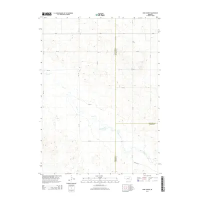
2014 Map of Park Church
USGS Topo · Published 2014About this map
Park Church stands as a focal landmark in this rural expanse of the Nebraska Sandhills, situated near the intersection of 511th Ave and 838th Rd. The landscape is defined by the winding course of Beaver Cr, which transitions into Beaver Creek as it flows southeast toward the tri-county corner of Wheeler, Antelope, and Boone counties. This 2014 survey illustrates a highly structured grid of section roads, including Ne-70 and Valley Rd, supporting a remote agricultural economy. The presence of Jennings Reservoir highlights local water management within the drainage basin of the Beaver Valley. For genealogists and local historians, the map preserves the exact positioning of rural landmarks and property access routes like Beaver Valley Rd and 506th Ave that have served these plains communities for generations.
Find a feature on this map
22 named features on this map. Tap any name to fly to it.
Don’t see what you’re looking for? This feature index may not catch every label — zoom into the map to look around manually.
Map Details
Editions of this 2014 Park Church Map
This is the sole edition of this map. No revisions or reprints were ever made.
Other maps of this area

1955 · Broken Bow
USGS Topo · 1:250,000

1955 · O'Neill
USGS Topo · 1:250,000

1956 · Broken Bow
USGS Topo · 1:250,000

1959 · O'Neill
USGS Topo · 1:250,000

1960 · Spalding 2 SW
USGS Topo · 1:24,000

1960 · Spalding 2 NW
USGS Topo · 1:24,000

1960 · Spalding 2 NE
USGS Topo · 1:24,000

1960 · Spalding 2 SE
USGS Topo · 1:24,000

1963 · Deloit
USGS Topo · 1:24,000

1963 · Deloit SW
USGS Topo · 1:24,000