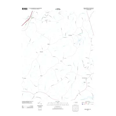
2013 Map of Park Spring
USGS Topo · Published 2013About this map
Moon Cr and its various tributaries, including the W Prong Moon Cr and E Prong Moon Cr, define the drainage patterns of this Caswell County landscape. Small rural communities are dispersed throughout the area, with Park Spring and Bethel situated central to several creek systems, while West Yanceyville sits near the southeastern corner. Aviation activity is noted at Caswell Airpark, providing a modern landmark in an otherwise largely agrarian and woodland setting. For genealogists, the Bethesda Church Cem located along the southern edge of the sheet provides a specific point of interest for family history research. The topography is marked by numerous small stream valleys and local water bodies like Park Spring Lake and Wildwood Lake, reflecting the character of the Piedmont region as it appeared in the early 21st century.
Find a feature on this map
92 named features on this map. Tap any name to fly to it.
Don’t see what you’re looking for? This feature index may not catch every label — zoom into the map to look around manually.
Map Details
Editions of this 2013 Park Spring Map
This is the sole edition of this map. No revisions or reprints were ever made.
Other maps of this area

1923 · Danville
USGS Topo · 1:48,000

1924 · Draper
USGS Topo · 1:48,000

1925 · Danville
USGS Topo · 1:62,500

1926 · Draper
USGS Topo · 1:62,500

1944 · Draper
USGS Topo · 1:62,500

1953 · Greensboro
USGS Topo · 1:250,000

1954 · Greensboro
USGS Topo · 1:250,000

1962 · Greensboro
USGS Topo · 1:250,000

1965 · Danville
USGS Topo · 1:24,000
1965 · Brosville
USGS Topo · 1:24,000