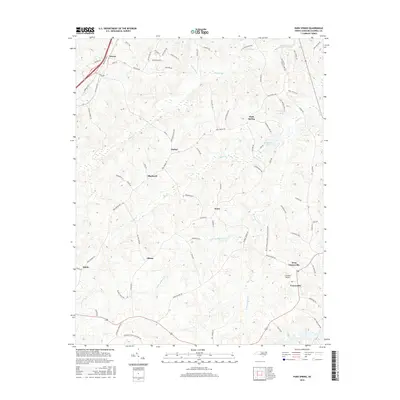
2016 Map of Park Spring
USGS Topo · Published 2016About this map
Yanceyville and its neighbor West Yanceyville anchor the southeastern corner of this Caswell County landscape, where the terrain is defined by the intricate branching of Hogans Creek and Moon Cr. In the mid-2010s, this area maintains a distinctly rural character, with small communities like Bethel, Blackwell, and Swann connected by a web of local roads such as Chigger Ridge Rd and Park Springs Rd. The map illustrates a high density of named family roads and local landmarks, including the Caswell Airport and the waters of Park Spring Lake. The drainage patterns of the E Prong Moon Cr and W Prong Moon Cr reveal the undulating topography that has long influenced the placement of these northern North Carolina settlements and their agricultural boundaries.
Find a feature on this map
80 named features on this map. Tap any name to fly to it.
Don’t see what you’re looking for? This feature index may not catch every label — zoom into the map to look around manually.
Map Details
Editions of this 2016 Park Spring Map
This is the sole edition of this map. No revisions or reprints were ever made.
Other maps of this area

1923 · Danville
USGS Topo · 1:48,000

1924 · Draper
USGS Topo · 1:48,000

1925 · Danville
USGS Topo · 1:62,500

1926 · Draper
USGS Topo · 1:62,500

1944 · Draper
USGS Topo · 1:62,500

1953 · Greensboro
USGS Topo · 1:250,000

1954 · Greensboro
USGS Topo · 1:250,000

1962 · Greensboro
USGS Topo · 1:250,000

1965 · Danville
USGS Topo · 1:24,000
1965 · Brosville
USGS Topo · 1:24,000