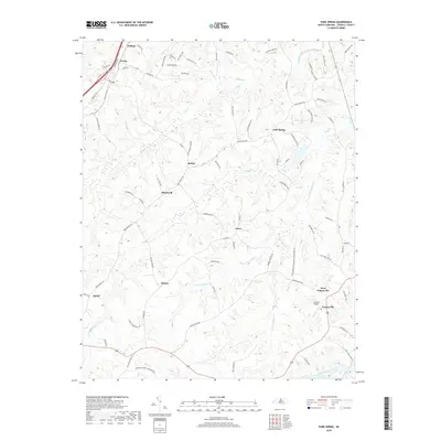
2019 Map of Park Spring
USGS Topo · Published 2019About this map
Yanceyville and the surrounding Caswell County countryside appear here in the late 2010s, characterized by a complex network of rural routes and the dendritic drainage of the Piedmont. The landscape is defined by the branching tributaries of Moon Creek and Hogans Creek, which carve through the terrain between small historic communities like Bethel, Blackwell, and Park Spring. Local history is visible in the naming of thoroughfares such as Bethesda Church Cemetery Rd and Chigger Ridge Rd, reflecting the area's long-standing social and geographic landmarks. The map details the transition from the concentrated settlement at West Yanceyville and the Caswell Airport to the more dispersed homesteads and farms found near Swann and Pelham in the northwest, providing a clear view of modern land use in this northern North Carolina border region.
Find a feature on this map
82 named features on this map. Tap any name to fly to it.
Don’t see what you’re looking for? This feature index may not catch every label — zoom into the map to look around manually.
Map Details
Editions of this 2019 Park Spring Map
This is the sole edition of this map. No revisions or reprints were ever made.
Other maps of this area

1923 · Danville
USGS Topo · 1:48,000

1924 · Draper
USGS Topo · 1:48,000

1925 · Danville
USGS Topo · 1:62,500

1926 · Draper
USGS Topo · 1:62,500

1944 · Draper
USGS Topo · 1:62,500

1953 · Greensboro
USGS Topo · 1:250,000

1954 · Greensboro
USGS Topo · 1:250,000

1962 · Greensboro
USGS Topo · 1:250,000

1965 · Danville
USGS Topo · 1:24,000
1965 · Brosville
USGS Topo · 1:24,000