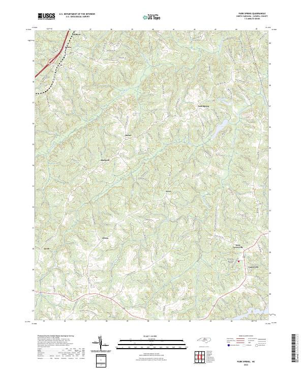
2022 Map of Park Spring
USGS Topo · Published 2022About this map
Hogans Creek and the branching waters of Moon Cr define the rolling landscape of northwestern Caswell County. This 2022 survey illustrates the dispersed rural settlement pattern characteristic of the region, where small communities like Bethel, Blackwell, and Jones are connected by a network of secondary roads. The terrain is marked by family-named landmarks and local infrastructure, such as Poteat Farm Rd and Rat Castle Rd, reflecting generations of land ownership.
Find a feature on this map
81 named features on this map. Tap any name to fly to it.
Don’t see what you’re looking for? This feature index may not catch every label — zoom into the map to look around manually.
Map Details
Editions of this 2022 Park Spring Map
This is the sole edition of this map. No revisions or reprints were ever made.
Other maps of this area

1923 · Danville
USGS Topo · 1:48,000

1924 · Draper
USGS Topo · 1:48,000

1925 · Danville
USGS Topo · 1:62,500

1926 · Draper
USGS Topo · 1:62,500

1944 · Draper
USGS Topo · 1:62,500

1953 · Greensboro
USGS Topo · 1:250,000

1954 · Greensboro
USGS Topo · 1:250,000

1962 · Greensboro
USGS Topo · 1:250,000

1965 · Danville
USGS Topo · 1:24,000
1965 · Brosville
USGS Topo · 1:24,000