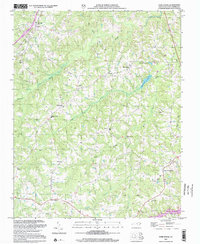
2002 Map of Park Spring
USGS Topo · Published 2002About this map
Hogans Creek and its many tributaries, including Moon Creek and Little Mill Creek, carve through this section of Caswell County. The landscape is defined by its rural community centers and ecclesiastical history, with numerous congregations such as Gwynns Chapel, New Ephesus Ch, and Bethesda Ch serving as focal points for the surrounding countryside. The map documents the area during a period of established residential growth, seen in the proximity of West Yanceyville and the development around Wildwood Lake. Local infrastructure is represented by the Caswell Airport in the south and a pipeline corridor crossing the terrain. Education and social hubs like Cobb Memorial Sch and settlements such as Bethel and Blackwell illustrate the distribution of long-standing family-named locales across the Piedmont region.
Find a feature on this map
33 named features on this map. Tap any name to fly to it.
Don’t see what you’re looking for? This feature index may not catch every label — zoom into the map to look around manually.
Map Details
Editions of this 2002 Park Spring Map
This is the sole edition of this map. No revisions or reprints were ever made.
Other maps of this area

1923 · Danville
USGS Topo · 1:48,000

1924 · Draper
USGS Topo · 1:48,000

1925 · Danville
USGS Topo · 1:62,500

1926 · Draper
USGS Topo · 1:62,500

1944 · Draper
USGS Topo · 1:62,500

1953 · Greensboro
USGS Topo · 1:250,000

1954 · Greensboro
USGS Topo · 1:250,000

1962 · Greensboro
USGS Topo · 1:250,000

1965 · Danville
USGS Topo · 1:24,000
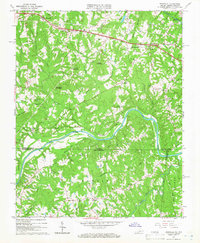
1965 · Brosville
USGS Topo · 1:24,000