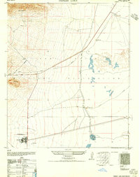
1956 Map of Parker Lake
USGS Topo · Published 1956About this map
The Fort Bliss Military Reservation dominates this desert landscape, where civilian and military activity overlap in the shadow of Buck Mountain. In the mid-1940s, this area was undergoing significant transition, evidenced by the numerous Abandoned routes and the presence of roads Under Construction leading toward White Sands. Water management was the critical factor for both livestock and military operations, marked by a network of catchments including Parker Lake, Haystack Tanks, and Hood Tank.
Find a feature on this map
27 named features on this map. Tap any name to fly to it.
Don’t see what you’re looking for? This feature index may not catch every label — zoom into the map to look around manually.
Map Details
Editions of this 1956 Parker Lake Map
This is the sole edition of this map. No revisions or reprints were ever made.
Other maps of this area

1891 · Las Cruces
USGS Topo · 1:125,000

1893 · Las Cruces
USGS Topo · 1:125,000

1916 · Tonuco
USGS Topo · 1:125,000

1916 · Point Of Sands
USGS Topo · 1:125,000

1932 · Tonuco
USGS Topo · 1:125,000

1941 · Organ Peak
USGS Topo · 1:62,500

1943 · Parker Lake
USGS Topo · 1:62,500

1943 · Organ Peak
USGS Topo · 1:62,500

1947 · Lake Lucero
USGS Topo · 1:62,500

1948 · Davies Tank
USGS Topo · 1:24,000