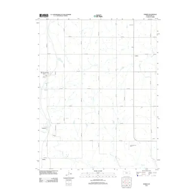
2012 Map of Parker
USGS Topo · Published 2012About this map
Cadmus and Goodrich anchor this rural Linn County landscape, where the agricultural grid is defined by a dense network of local roads including Hadsall Rd and Iliff Rd. The area is drained by numerous winding waterways, notably Elm Cr and Davis Cr, which cut through the section lines and define the natural drainage patterns of the eastern Kansas plains.
Find a feature on this map
36 named features on this map. Tap any name to fly to it.
Don’t see what you’re looking for? This feature index may not catch every label — zoom into the map to look around manually.
Map Details
Editions of this 2012 Parker Map
This is the sole edition of this map. No revisions or reprints were ever made.
Other maps of this area

1885 · Garnett
USGS Topo · 1:125,000

1887 · Mound City
USGS Topo · 1:125,000

1893 · Mound City
USGS Topo · 1:125,000

1894 · Garnett
USGS Topo · 1:125,000

1947 · Lawrence
USGS Topo · 1:250,000

1950 · Lawrence
USGS Topo · 1:250,000

1956 · Lawrence
USGS Topo · 1:250,000

1958 · La Cygne
USGS Topo · 1:24,000
1958 · Fontana
USGS Topo · 1:24,000
1958 · Mound City
USGS Topo · 1:24,000