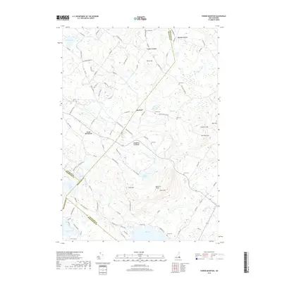
2018 Map of Parker Mountain
USGS Topo · Published 2018About this map
Strafford sits at the heart of this landscape where the Big River and Little River weave through the southeastern foothills of the Blue Hills Range. This modern survey illustrates a rural New Hampshire environment defined by its dispersed hamlets and high concentration of family burial grounds, including the McNeal Cem near Lockes Corner and the Perkins Cem further south. The topography is anchored by Parker Mtn and Evans Mtn, while the southwestern corner is marked by the expansive waters of Bow Lake. For those tracing local history, the map preserves the locations of several smaller settlements like Leighton Corners and South Barnstead, alongside distinctive terrain features such as Barn Door Gap and Sanders Ledge.
Find a feature on this map
95 named features on this map. Tap any name to fly to it.
Don’t see what you’re looking for? This feature index may not catch every label — zoom into the map to look around manually.
Map Details
Editions of this 2018 Parker Mountain Map
This is the sole edition of this map. No revisions or reprints were ever made.
Other maps of this area

1917 · Mt. Pawtuckaway
USGS Topo · 1:62,500

1919 · Mt. Pawtuckaway
USGS Topo · 1:62,500

1919 · Gilmanton
USGS Topo · 1:62,500

1919 · Alton
USGS Topo · 1:62,500

1921 · Suncook
USGS Topo · 1:62,500

1927 · Gilmanton
USGS Topo · 1:62,500

1939 · Mt. Pawtuckaway
USGS Topo · 1:62,500

1944 · Mt. Pawtuckaway
USGS Topo · 1:62,500

1944 · Suncook
USGS Topo · 1:62,500

1949 · Portland
USGS Topo · 1:250,000