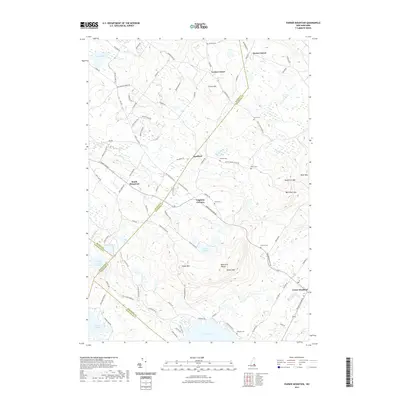
2021 Map of Parker Mountain
USGS Topo · Published 2021About this map
Strafford and its outlying hamlets occupy a landscape of interconnected river valleys and ridgelines where the Big River and Little River wind through the hills. This 2021 survey reveals a settlement pattern anchored by historic family-named locations such as Leighton Corners and Lockes Corner. Genealogists will find a high density of small family burial grounds, including the McNeal Cem and Jones Cem, scattered among the rural roads. The southern portion of the map is dominated by the elevations of the Blue Hills Range, peaking at Parker Mtn and Evans Mtn, which overlook the significant shoreline of Bow Lake. This modern data shows how the early interior settlements of South Barnstead and Center Strafford have maintained their character amid the wooded terrain of Strafford County.
Find a feature on this map
97 named features on this map. Tap any name to fly to it.
Don’t see what you’re looking for? This feature index may not catch every label — zoom into the map to look around manually.
Map Details
Editions of this 2021 Parker Mountain Map
This is the sole edition of this map. No revisions or reprints were ever made.
Other maps of this area

1917 · Mt. Pawtuckaway
USGS Topo · 1:62,500

1919 · Mt. Pawtuckaway
USGS Topo · 1:62,500

1919 · Gilmanton
USGS Topo · 1:62,500

1919 · Alton
USGS Topo · 1:62,500

1921 · Suncook
USGS Topo · 1:62,500

1927 · Gilmanton
USGS Topo · 1:62,500

1939 · Mt. Pawtuckaway
USGS Topo · 1:62,500

1944 · Mt. Pawtuckaway
USGS Topo · 1:62,500

1944 · Suncook
USGS Topo · 1:62,500

1949 · Portland
USGS Topo · 1:250,000