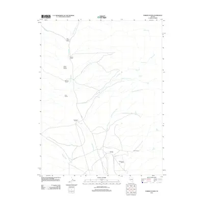
2012 Map of Parker Station
USGS Topo · Published 2012About this map
Parker Station (Historical) and the Cave Valley Post Office anchor this study of eastern Nevada's high-desert drainage systems. The landscape is defined by the convergence of several major canyons and washes, including Milk Ranch Canyon, Willow Spring Canyon, and the extensive Cave Valley Wash, which serves as a primary geographic spine. These dry watercourses are punctuated by numerous isolated water sources such as Wildcat Spring, Sagehen Spring, and Quartzite Spring, which were vital for early settlement and stock-raising. The transport network consists of rural corridors like Co RD 45 and Haggerty RD, reflecting the area's continued use for ranching and resource access. The naming of features like Blue Rock Canyon and Lanter Canyon suggests a long history of local identification within this arid environment.
Find a feature on this map
28 named features on this map. Tap any name to fly to it.
Don’t see what you’re looking for? This feature index may not catch every label — zoom into the map to look around manually.
Map Details
Editions of this 2012 Parker Station Map
This is the sole edition of this map. No revisions or reprints were ever made.
Other maps of this area

1956 · Lund
USGS Topo · 1:250,000

1960 · Lund
USGS Topo · 1:250,000

1969 · Shingle Pass
USGS Topo · 1:24,000

1969 · Parker Station
USGS Topo · 1:24,000

1969 · Shingle Pass SE
USGS Topo · 1:24,000

1969 · Haggerty Spring
USGS Topo · 1:24,000

1973 · Cattle Camp Spring
USGS Topo · 1:24,000
1977 · Bullwhack Summit
USGS Topo · 1:24,000
1977 · Brown Knoll
USGS Topo · 1:24,000
1978 · Mt. Grafton
USGS Topo · 1:24,000