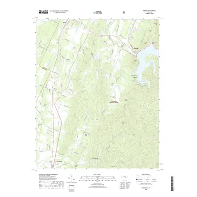
2019 Map of Parksville
USGS Topo · Published 2019About this map
Lake Ocoee and the Ocoee River dominate the northeastern landscape of this quadrangle, where the mountains of the Cherokee National Forest meet the valley floors of southeast Tennessee. This area is characterized by a dense concentration of family and community burial grounds, including the Hillard-Ladd Cem, Dills Cem, and Fitzsimmons Cem, providing a significant record for genealogical research. The map captures the distinct settlement patterns at Oldfort and Ball Play, connected by historic routes like the Old Federal Rd. The terrain is defined by prominent peaks such as Sugarloaf Mtn and the Tennessee Valley Divide, which separates the numerous creek drainages flowing through the region. Small agricultural and forest communities like Willis Springs and Conasauga anchor the southern portion of the sheet, while recreational sites like Camp Ocoee and Parksville Beach illustrate the river's importance to local life.
Find a feature on this map
125 named features on this map. Tap any name to fly to it.
Don’t see what you’re looking for? This feature index may not catch every label — zoom into the map to look around manually.
Map Details
Editions of this 2019 Parksville Map
This is the sole edition of this map. No revisions or reprints were ever made.
Other maps of this area

1886 · Dalton
USGS Topo · 1:125,000

1886 · Cleveland
USGS Topo · 1:125,000

1892 · Cleveland
USGS Topo · 1:125,000

1892 · Dalton
USGS Topo · 1:125,000

1895 · Cleveland
USGS Topo · 1:125,000

1897 · Dalton
USGS Topo · 1:125,000

1901 · Cleveland
USGS Topo · 1:125,000

1911 · Cohutta Mtn
USGS Topo · 1:62,500

1913 · Cohutta Mtn.
USGS Topo · 1:62,500

1935 · East Cleveland
USGS Topo · 1:24,000