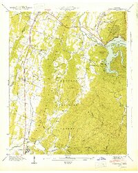
1943 Map of Parksville
USGS Topo · Published 1946About this map
Lake Ocoee dominates the northeastern landscape of this mid-century survey, held back by the Ocoee Power Plant Dam No 1 on the Ocoee River. The terrain is characterized by the prominent ridges of Sand Mountain and the Blue Ridge Mountain, with the Tennessee Valley Divide cutting through the center. This region within the Cherokee National Forest shows a scattered network of rural settlements and institutions, including the Horns Creek Sch and various churches like Beech Springs Ch and Cumberland Shed Ch. Transportation in the western valley is anchored by the Louisville and Nashville railroad, which parallels South Chestuee Creek near the settlements of Ocoee and Oldfort. The map records several family-named burial grounds such as Dills Cem and Hillard-Ladd Cem, providing valuable data for genealogical research in Polk County.
Find a feature on this map
66 named features on this map. Tap any name to fly to it.
Don’t see what you’re looking for? This feature index may not catch every label — zoom into the map to look around manually.
Map Details
Editions of this 1943 Parksville Map
This is the sole edition of this map. No revisions or reprints were ever made.
Other maps of this area

1886 · Dalton
USGS Topo · 1:125,000

1886 · Cleveland
USGS Topo · 1:125,000

1892 · Cleveland
USGS Topo · 1:125,000

1892 · Dalton
USGS Topo · 1:125,000

1895 · Cleveland
USGS Topo · 1:125,000

1897 · Dalton
USGS Topo · 1:125,000

1901 · Cleveland
USGS Topo · 1:125,000

1911 · Cohutta Mtn
USGS Topo · 1:62,500

1913 · Cohutta Mtn.
USGS Topo · 1:62,500

1935 · East Cleveland
USGS Topo · 1:24,000