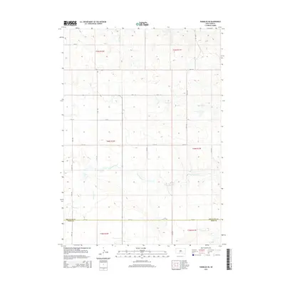
2015 Map of Parmelee NE
USGS Topo · Published 2015About this map
Gray Eagletail Creek and Swimmer Creek define the drainage patterns of this prairie landscape, where the administrative boundary between Mellette County and Todd County runs along the southern portion of the survey. The terrain is characterized by a sparse, rhythmic grid of rural section roads, including 250th Avenue and 274th Street, which follow the Public Land Survey System divisions. In the north, the headwaters of North Branch Pine Creek and South Branch Pine Creek carve subtle relief into the plains, while Cut Meat Creek enters the frame in the southeast. This 2015 update reflects the modern landscape of the Horse Creek Segment, documenting the enduring geometry of range and township lines in south-central South Dakota.
Find a feature on this map
24 named features on this map. Tap any name to fly to it.
Don’t see what you’re looking for? This feature index may not catch every label — zoom into the map to look around manually.
Map Details
Editions of this 2015 Parmelee NE Map
This is the sole edition of this map. No revisions or reprints were ever made.
Other maps of this area

1955 · Martin
USGS Topo · 1:250,000

1958 · Martin
USGS Topo · 1:250,000

1969 · Norris
USGS Topo · 1:24,000

1969 · Eagle Mans Butte
USGS Topo · 1:24,000

1969 · Parmelee NE
USGS Topo · 1:24,000

1969 · Soldier Creek
USGS Topo · 1:24,000

1969 · Parmelee
USGS Topo · 1:24,000

1969 · Soldier Creek NW
USGS Topo · 1:24,000

1980 · Kadoka
USGS Topo · 1:100,000

1981 · Cedar Butte
USGS Topo · 1:25,000