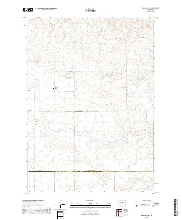
2021 Map of Parmelee NE
USGS Topo · Published 2021About this map
Saint John Lutheran Cem stands as a focal point of local history on this high plains landscape along 251st Ave. This 2021 survey reveals a territory defined by its watercourses and rural section lines, marking the border between Mellette County and Todd County. The drainage patterns are clearly delineated, showing how Swimmer Creek and Gray Eagletail Creek carve through the terrain. The map's grid is established by local routes like Co Line Rd and 270th St, providing a precise look at land divisions and the location of N Br Pine Creek and S Br Pine Creek as they flow through the northern sections. This detailed topographic study offers genealogists and local historians a reliable reference for the placement of family landmarks and rural infrastructure in this part of South Dakota.
Find a feature on this map
21 named features on this map. Tap any name to fly to it.
Don’t see what you’re looking for? This feature index may not catch every label — zoom into the map to look around manually.
Map Details
Editions of this 2021 Parmelee NE Map
This is the sole edition of this map. No revisions or reprints were ever made.
Other maps of this area

1955 · Martin
USGS Topo · 1:250,000

1958 · Martin
USGS Topo · 1:250,000

1969 · Norris
USGS Topo · 1:24,000

1969 · Eagle Mans Butte
USGS Topo · 1:24,000

1969 · Parmelee NE
USGS Topo · 1:24,000

1969 · Soldier Creek
USGS Topo · 1:24,000

1969 · Parmelee
USGS Topo · 1:24,000

1969 · Soldier Creek NW
USGS Topo · 1:24,000

1980 · Kadoka
USGS Topo · 1:100,000

1981 · Cedar Butte
USGS Topo · 1:25,000