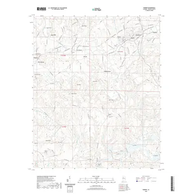
2020 Map of Parrish
USGS Topo · Published 2020About this map
Parrish and Oakman anchor this Walker County landscape, showing the complex interaction of settlement and geography in a region shaped by industry and topography. The BNSF Railway corridor connects communities like Standard and America in the northeast, while the southern reaches are defined by the winding course of Wolf Creek and The Narrows. Genealogists will find a high density of burial sites including Liberty Hill Cem, Gilchrist Cem, and Pleasant Field Cem, often situated near older crossings like Evans Bridge. The terrain is marked by distinctive hollows and ridges such as Artesian Hollow and Gayosa Mtn, with Strip Mining Impoundment Number 1 reflecting the long-term impact of resource extraction on the local environment.
Find a feature on this map
126 named features on this map. Tap any name to fly to it.
Don’t see what you’re looking for? This feature index may not catch every label — zoom into the map to look around manually.
Map Details
Editions of this 2020 Parrish Map
This is the sole edition of this map. No revisions or reprints were ever made.
Other maps of this area

1893 · Jasper
USGS Topo · 1:125,000

1935 · Port Birmingham
USGS Topo · 1:48,000

1938 · Port Birmingham
USGS Topo · 1:62,500

1949 · Cordova
USGS Topo · 1:24,000

1949 · Parrish
USGS Topo · 1:24,000

1949 · Townley
USGS Topo · 1:24,000

1949 · Jasper
USGS Topo · 1:24,000

1949 · Oakman
USGS Topo · 1:24,000

1949 · Tutwiler School
USGS Topo · 1:24,000

1949 · Wiley
USGS Topo · 1:24,000