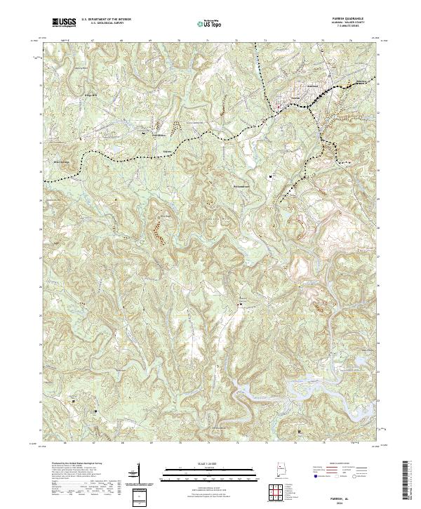
2024 Map of Parrish
USGS Topo · Published 2024About this map
Parrish serves as a central hub in this part of Walker County, where the BNSF Railway intersects with a network of local roads including the New Parrish Hwy and America Junction Rd. The landscape is defined by the winding paths of Wolf Creek and Lost Creek, carving through terrain marked by heights such as Gayosa Mtn and Clemments Mtn. This area reflects a long history of coal country settlement, with small communities like Standard, America, and Providence scattered among the ridges.
Find a feature on this map
124 named features on this map. Tap any name to fly to it.
Don’t see what you’re looking for? This feature index may not catch every label — zoom into the map to look around manually.
Map Details
Editions of this 2024 Parrish Map
This is the sole edition of this map. No revisions or reprints were ever made.
Other maps of this area

1893 · Jasper
USGS Topo · 1:125,000

1935 · Port Birmingham
USGS Topo · 1:48,000

1938 · Port Birmingham
USGS Topo · 1:62,500

1949 · Cordova
USGS Topo · 1:24,000

1949 · Parrish
USGS Topo · 1:24,000

1949 · Townley
USGS Topo · 1:24,000

1949 · Jasper
USGS Topo · 1:24,000

1949 · Oakman
USGS Topo · 1:24,000

1949 · Tutwiler School
USGS Topo · 1:24,000

1949 · Wiley
USGS Topo · 1:24,000