
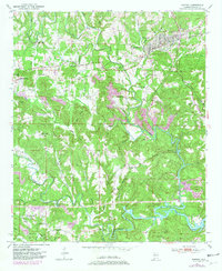
1949 Map of Parrish
USGS Topo · Published 1967About this map
Parrish and the neighboring settlements of Standard and America anchor this postwar look at the Walker County coalfields. The Southern railroad line winds through the landscape, serving industrial sites like the Strip Mine while connecting remote outposts such as Gayosa and Providence. The terrain is defined by the deep carving of Lost Creek and Wolf Creek, which create narrow valleys and prominent landmarks like Clemments Mountain and the Blue Ridge.
Find a feature on this map
51 named features on this map. Tap any name to fly to it.
Don’t see what you’re looking for? This feature index may not catch every label — zoom into the map to look around manually.
Map Details
Editions of this 1949 Parrish Map
2 editions found
Other maps of this area

1893 · Jasper
USGS Topo · 1:125,000

1935 · Port Birmingham
USGS Topo · 1:48,000

1938 · Port Birmingham
USGS Topo · 1:62,500

1949 · Cordova
USGS Topo · 1:24,000

1949 · Townley
USGS Topo · 1:24,000

1949 · Jasper
USGS Topo · 1:24,000

1949 · Oakman
USGS Topo · 1:24,000

1949 · Tutwiler School
USGS Topo · 1:24,000

1949 · Wiley
USGS Topo · 1:24,000

1951 · Jasper
USGS Topo · 1:24,000