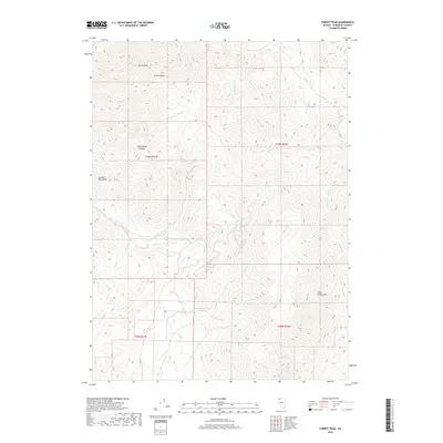
2018 Map of Parrot Peak
USGS Topo · Published 2018About this map
Parrot Peak and the high ridges of the Jackson Mountains dominate this high-desert landscape in northwestern Nevada. The drainage patterns on these slopes reveal a complex system of seasonal and perennial waterways, where Mary Sloan Cr and Mike O'Brien Canyon carve into the western faces while the W Fork Happy Cr and E Fork Happy Cr drain the eastern reaches. The presence of Willow Spring in the southern portion of the range highlights the critical nature of water sources in this arid environment. This topographical study also details the intersection of the Jackson Cr and Trout Cr basins, providing a clear record of the watershed near Trout Creek Spur and the surrounding public land survey sections.
Find a feature on this map
24 named features on this map. Tap any name to fly to it.
Don’t see what you’re looking for? This feature index may not catch every label — zoom into the map to look around manually.
Map Details
Editions of this 2018 Parrot Peak Map
This is the sole edition of this map. No revisions or reprints were ever made.
Other maps of this area

1886 · Disaster
USGS Topo · 1:250,000

1893 · Disaster
USGS Topo · 1:250,000

1954 · Vya
USGS Topo · 1:250,000

1958 · Vya
USGS Topo · 1:250,000

1961 · Bottle Creek
USGS Topo · 1:62,500

1962 · Vya
USGS Topo · 1:250,000

1966 · Donna Schee Peak
USGS Topo · 1:62,500

1966 · King Lear Peak
USGS Topo · 1:62,500

1972 · Deer Creek Slough
USGS Topo · 1:24,000

1972 · Hobo Canyon
USGS Topo · 1:24,000