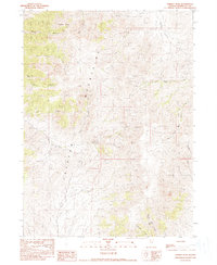
1990 Map of Parrot Peak
USGS Topo · Published 1990About this map
Parrot Peak stands as the literal and figurative height of this study of the Jackson Mountains during the late twentieth century. This desert range is characterized by steep drainage systems like Blind Canyon and Mike O'Brian Canyon, where the landscape is etched by a complex network of seasonal watercourses. The presence of the Humboldt Mine, Redbird Mine, and the Iron King Mine indicates a history of resource extraction tucked into the steep slopes, reflecting the mining economy that has long defined this part of Nevada.
Find a feature on this map
19 named features on this map. Tap any name to fly to it.
Don’t see what you’re looking for? This feature index may not catch every label — zoom into the map to look around manually.
Map Details
Editions of this 1990 Parrot Peak Map
This is the sole edition of this map. No revisions or reprints were ever made.
Other maps of this area

1886 · Disaster
USGS Topo · 1:250,000

1893 · Disaster
USGS Topo · 1:250,000

1954 · Vya
USGS Topo · 1:250,000

1958 · Vya
USGS Topo · 1:250,000

1961 · Bottle Creek
USGS Topo · 1:62,500

1962 · Vya
USGS Topo · 1:250,000

1966 · Donna Schee Peak
USGS Topo · 1:62,500

1966 · King Lear Peak
USGS Topo · 1:62,500

1972 · Deer Creek Slough
USGS Topo · 1:24,000

1972 · Hobo Canyon
USGS Topo · 1:24,000