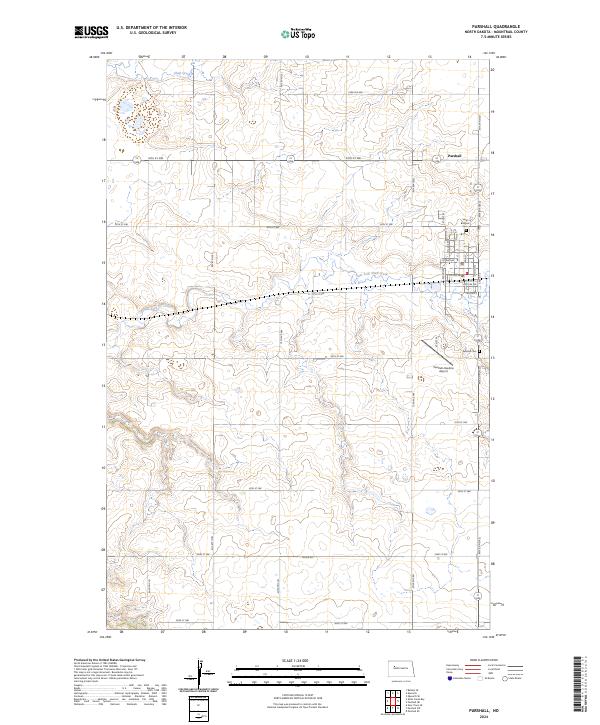
2024 Map of Parshall
USGS Topo · Published 2024About this map
The town of Parshall serves as the focal point of this Mountrail County landscape, situated amidst the agricultural plateaus of western North Dakota. The community is defined by a traditional grid of streets, including Main St and 1st Ave NW, which support the local residential and commercial center. Just outside the main settlement, the Parshall-Hankins Airport provides a vital regional aviation link, reflecting the specialized transportation needs of the Great Plains. The drainage patterns of Shell Creek and its East Fork carve subtle valleys across the terrain, shaping the orientation of the rural road network, which follows the rigid section lines of the Public Land Survey System. Genealogists will find the locations of Saint Bridgets Cem and Parshall Cem particularly useful for identifying family history sites within the township of t152n r90w.
Find a feature on this map
33 named features on this map. Tap any name to fly to it.
Don’t see what you’re looking for? This feature index may not catch every label — zoom into the map to look around manually.
Map Details
Editions of this 2024 Parshall Map
This is the sole edition of this map. No revisions or reprints were ever made.
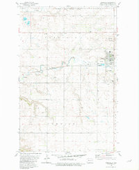
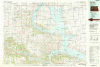
Historical Maps of Parshall Through Time
3 maps found