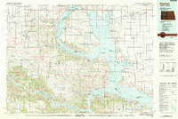
1982 Map of Parshall
USGS Topo · Published 1983About this map
The Fort Berthold Indian Reservation and the sprawling waters of Lake Sakakawea dominate this western North Dakota landscape in the early 1980s. This survey illustrates the intricate relationship between the Missouri River system and the modern energy economy, mapping the Antelope Oil Field and the Clear Creek Oil and Gas Field in the west, while the Soo Line railroad connects the agricultural and transport hubs of Parshall and Raub. Significant terrain features like the Blue Buttes and Kummer Ridge stand in contrast to the numerous public use areas and wildlife management zones along the lake's fingers, such as the Van Hook Arm. The map documents established communities like New Town, Sanish, and Mandaree, alongside local landmarks including the Riverview Cem and the Municipal Airport serving the region's diverse rural and industrial needs.
Find a feature on this map
95 named features on this map. Tap any name to fly to it.
Don’t see what you’re looking for? This feature index may not catch every label — zoom into the map to look around manually.
Map Details
Editions of this 1982 Parshall Map
This is the sole edition of this map. No revisions or reprints were ever made.
Other maps of this area

1911 · Ray
USGS Topo · 1:125,000

1953 · Williston
USGS Topo · 1:250,000

1953 · Watford City
USGS Topo · 1:250,000

1954 · Minot
USGS Topo · 1:250,000

1954 · McClusky
USGS Topo · 1:250,000

1956 · Makoti SW
USGS Topo · 1:24,000

1956 · Blackwater Lake NW
USGS Topo · 1:24,000

1957 · Williston
USGS Topo · 1:250,000

1957 · Watford City
USGS Topo · 1:250,000

1958 · McClusky
USGS Topo · 1:250,000