
1954 Map of Minot
USGS Topo · Published 1964About this map
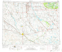
The Souris River carves a distinct path across this northern landscape, defining a region where water management and conservation dominate the terrain. Multiple wildlife sanctuaries, including the Lower Souris National Wildlife Refuge and Upper Souris National Wildlife Refuge, illustrate the mid-century commitment to preserving the wetlands of the Central Flyway. To the northeast, the Turtle Mountains rise above the plains, dotted with numerous small lakes like Lake Dana and Fish Lake. The map reveals a robust agricultural infrastructure supported by the Great Northern railroad, which connects small grain-handling settlements and sidings such as Tasco Siding and Armen Siding. Local transportation relies on crossings like St Marys Bridge and Schilling Bridge, while the presence of Aerial Spraying Service and Minot International airport underscores the era's evolving aviation and farming practices.
Find a feature on this map
144 named features on this map. Tap any name to fly to it.
Don’t see what you’re looking for? This feature index may not catch every label — zoom into the map to look around manually.
Map Details
Editions of this 1954 Minot Map
3 editions found
Other maps of this area

1928 · Minot
USGS Topo · 1:62,500

1929 · Sawyer
USGS Topo · 1:62,500

1929 · Benedict
USGS Topo · 1:62,500

1929 · Kongsberg
USGS Topo · 1:62,500

1929 · Balfour
USGS Topo · 1:62,500

1930 · Drake
USGS Topo · 1:62,500

1935 · Dunseith
USGS Topo · 1:48,000

1936 · Lake Upsilon
USGS Topo · 1:48,000

1939 · Dunseith
USGS Topo · 1:62,500

1940 · Aylmer
USGS Topo · 1:62,500