
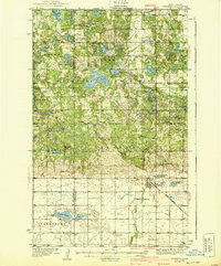
1939 Map of Dunseith
USGS Topo · Published 1939About this map
Turtle Mountains dominate the northern landscape of this Rolette County survey, where a high density of small lakes and prairie potholes reflects the glacial topography of the region. Near the Canadian border, the International Peace Garden and its Peace Monument stand alongside a CCC Camp, documenting the area's development during the 1930s. The settlement of Dunseith serves as a southern hub, situated along the Great Northern railroad line near Riverside Cem and St Louis Cem.
Find a feature on this map
66 named features on this map. Tap any name to fly to it.
Don’t see what you’re looking for? This feature index may not catch every label — zoom into the map to look around manually.
Map Details
Editions of this 1939 Dunseith Map
2 editions found
Other maps of this area

1935 · Dunseith
USGS Topo · 1:48,000

1936 · Lake Upsilon
USGS Topo · 1:48,000

1942 · Lake Upsilon
USGS Topo · 1:62,500

1953 · Devils Lake
USGS Topo · 1:250,000

1954 · Omemee
USGS Topo · 1:24,000

1954 · Minot
USGS Topo · 1:250,000

1955 · Fonda
USGS Topo · 1:24,000

1955 · Thorne
USGS Topo · 1:24,000

1955 · Lords Lake
USGS Topo · 1:24,000

1955 · Dunseith
USGS Topo · 1:24,000