Loading...
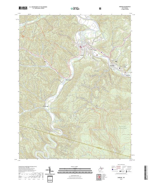
Loading map...2023 Map of Parsons
USGS Topo · Published 2023About this map
Parsons serves as the focal point of this region where the Shavers Fork and Black Fork converge to form the Cheat River. As the county seat, it houses the Tucker County Courthouse, anchoring a network of small mountain settlements including Hambleton, Hendricks, and Porterwood. The landscape is defined by the steep rises of McGowan Mtn and Fork Mtn, with much of the southern and eastern terrain protected within the Monongahela National Forest and the Otter Creek Wilderness.
Find a feature on this map
65 named features on this map. Tap any name to fly to it.
Don’t see what you’re looking for? This feature index may not catch every label — zoom into the map to look around manually.
Map Details
Date Portrayed2023
Date Published2023
PublisherU.S. Geological Survey
Map TypeTopographic
Scale1:24000
Physical Dimensions24 x 29 inches
Editions of this 2023 Parsons Map
This is the sole edition of this map. No revisions or reprints were ever made.
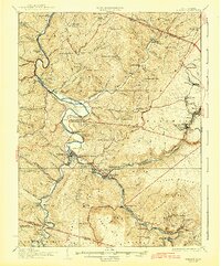
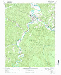
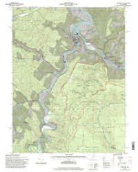
Historical Maps of Parsons Through Time
5 maps found

Featured Locations
Source Details
SourceU.S. Geological Survey
CopyrightPublic Domain