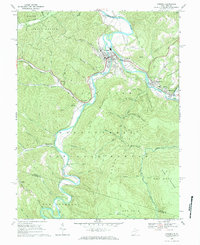
1968 Map of Parsons
USGS Topo · Published 1984About this map
The confluence of the Shavers Fork and Black Fork rivers creates the Cheat River at the northern edge of this West Virginia study. The settlement of Parsons serves as the focal point of the local valley, where the Western Maryland railroad follows the riverbanks to connect industrial and residential hubs like Hambleton and Hendricks. The landscape is defined by the steep rises of Backbone Mtn and McGowan Mountain, which hem in these river towns. Significant portions of the quadrangle are protected within the Monongahela National Forest, preserving the wooded hollows and ridges that characterize the Tucker County terrain. Genealogists will find a cluster of family burial sites near the eastern settlements, including the Goff Cem, Collett Cem, and Hamrick Cem, alongside local landmarks like Irons Chapel and Farmers Chapel in the smaller valley communities.
Find a feature on this map
75 named features on this map. Tap any name to fly to it.
Don’t see what you’re looking for? This feature index may not catch every label — zoom into the map to look around manually.
Map Details
Editions of this 1968 Parsons Map
2 editions found
Other maps of this area

1886 · St. George
USGS Topo · 1:125,000

1889 · Beverly
USGS Topo · 1:125,000

1891 · St. George
USGS Topo · 1:125,000

1892 · Beverly
USGS Topo · 1:125,000

1907 · Belington
USGS Topo · 1:62,500

1908 · Parsons
USGS Topo · 1:62,500

1909 · Elkins
USGS Topo · 1:62,500

1922 · Horton
USGS Topo · 1:48,000

1924 · Horton
USGS Topo · 1:62,500

1926 · Parsons
USGS Topo · 1:62,500