
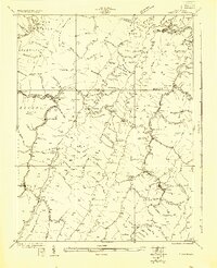
1922 Map of Horton
USGS Topo · Published 1922About this map
Monongahela National Forest dominates this landscape in the early 1920s, a period when small timber and agricultural settlements were firmly established along the winding river valleys. The logging influence is evident in the cluster of mountain communities like Whitmer and Horton, while the more agricultural character of the region is preserved through a high density of rural schoolhouses such as Chestnut Grove School, Mylius School, and Pine Grove School.
Find a feature on this map
103 named features on this map. Tap any name to fly to it.
Don’t see what you’re looking for? This feature index may not catch every label — zoom into the map to look around manually.
Map Details
Editions of this 1922 Horton Map
2 editions found
Other maps of this area

1886 · St. George
USGS Topo · 1:125,000

1889 · Beverly
USGS Topo · 1:125,000

1891 · St. George
USGS Topo · 1:125,000

1892 · Beverly
USGS Topo · 1:125,000

1892 · Franklin
USGS Topo · 1:125,000

1895 · Piedmont
USGS Topo · 1:125,000

1896 · Franklin
USGS Topo · 1:125,000

1907 · Belington
USGS Topo · 1:62,500

1908 · Parsons
USGS Topo · 1:62,500

1909 · Elkins
USGS Topo · 1:62,500