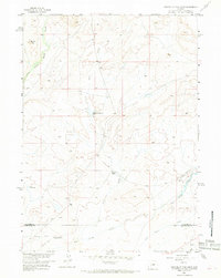
1958 Map of Parting of the Ways
USGS Topo · Published 1968About this map
The Historic Monument (Parting of the Ways) marks a pivotal junction in the high desert of the Wyoming basin, where westward-bound travelers chose between diverging paths. This 1958 survey documents the crossing of the Emigrant Trail and the Sublette Cutoff Emigrant Trail as they traverse the arid landscape near the border of Sublette and Sweetwater counties. The area is defined by seasonal watercourses and remote landmarks, including the Old Juel Ranch situated along Juel Creek.
Find a feature on this map
13 named features on this map. Tap any name to fly to it.
Don’t see what you’re looking for? This feature index may not catch every label — zoom into the map to look around manually.
Map Details
Editions of this 1958 Parting of the Ways Map
3 editions found
Other maps of this area

1955 · Lander
USGS Topo · 1:250,000

1958 · Lander
USGS Topo · 1:250,000

1958 · Parting of the Ways
USGS Topo · 1:62,500

1958 · Essex Mountain
USGS Topo · 1:62,500

1958 · Hay Meadow Reservoir
USGS Topo · 1:24,000

1958 · Tule Butte
USGS Topo · 1:24,000

1958 · Parting of the Ways
USGS Topo · 1:24,000

1961 · Lander
USGS Topo · 1:250,000

1968 · Eden Reservoir East
USGS Topo · 1:24,000

1969 · Leckie Reservoir
USGS Topo · 1:24,000