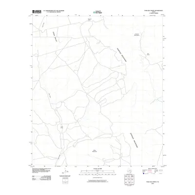
2010 Map of Paso Del Norte
USGS Topo · Published 2010About this map
Paso del Norte serves as the focal point for this Brewster County landscape, where the high desert terrain is defined by a network of drainage systems and prominent peaks. The massive Santiago Mountains dominate the eastern reaches, while the Cochran Mountains rise in the northeast. Water and erosion have carved distinct pathways through the earth, notably the long corridor of Chalk Valley and the intermittent flow of Chalk Draw. The local geography is further marked by Black Mountain to the south and the deep indent of Bear Canyon. This modern topographic study reveals a sparse network of roads navigating the complex elevations, illustrating how the natural landforms dictated transportation routes and settlement in this corner of the Big Bend region long after the first ranchers arrived.
Find a feature on this map
7 named features on this map. Tap any name to fly to it.
Don’t see what you’re looking for? This feature index may not catch every label — zoom into the map to look around manually.
Map Details
Editions of this 2010 Paso Del Norte Map
This is the sole edition of this map. No revisions or reprints were ever made.
Other maps of this area

1895 · Alpine
USGS Topo · 1:125,000

1917 · Santiago Peak
USGS Topo · 1:62,500

1917 · Buck Hill
USGS Topo · 1:62,500

1918 · Bone Spring
USGS Topo · 1:125,000

1918 · Buck Hill
USGS Topo · 1:62,500

1918 · Santiago Peak
USGS Topo · 1:62,500

1920 · Monument Spring
USGS Topo · 1:62,500

1921 · Monument Spring
USGS Topo · 1:62,500

1925 · Buck Hill
USGS Topo · 1:62,500
1938 · Santiago Peak
USGS Topo · 1:62,500