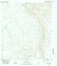
1983 Map of Paso Del Norte
USGS Topo · Published 1984About this map
Paso Del Norte sits at the northern edge of a high-altitude landscape where the Santiago Mountains meet the Cochran Mountains. This 1983 survey illustrates a terrain defined by isolation and the search for resources, evidenced by the scattered Tank and Water Tank labels and the isolated Sulfur Windmill. The presence of a Drill Hole and several jeep trails suggests ongoing exploration or ranching activities within the expansive Chalk Valley and along the base of Black Mountain. The drainage of Chalk Draw and the narrow passage of Bear Canyon provide a detailed look at the hydrology of Brewster County during the late twentieth century, showing a region where landmarks like Combs and Del Norte are separated by miles of open ground.
Find a feature on this map
15 named features on this map. Tap any name to fly to it.
Don’t see what you’re looking for? This feature index may not catch every label — zoom into the map to look around manually.
Map Details
Editions of this 1983 Paso Del Norte Map
This is the sole edition of this map. No revisions or reprints were ever made.
Other maps of this area

1895 · Alpine
USGS Topo · 1:125,000

1917 · Santiago Peak
USGS Topo · 1:62,500

1917 · Buck Hill
USGS Topo · 1:62,500

1918 · Bone Spring
USGS Topo · 1:125,000

1918 · Buck Hill
USGS Topo · 1:62,500

1918 · Santiago Peak
USGS Topo · 1:62,500

1920 · Monument Spring
USGS Topo · 1:62,500

1921 · Monument Spring
USGS Topo · 1:62,500

1925 · Buck Hill
USGS Topo · 1:62,500
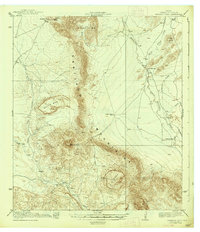
1938 · Santiago Peak
USGS Topo · 1:62,500