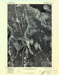
1975 Map of Passadumkeag
USGS Topo · Published 1981About this map
The confluence of the Passadumkeag River and the Penobscot River anchor this 1975 orthophotoquad, which uses aerial photography to document the water-bound landscape of central Maine. The settlement of Passadumkeag sits at this strategic river junction, while Enfield appears further north near the southern reaches of Cold Stream Pond. The imagery highlights the complex drainage patterns of the region, specifically the tightly winding meanders of Cold Stream as it flows south toward the main river. Smaller tributaries like Little Cold Stream, Beaver Brook, and Olamon Stream cut through the heavily forested terrain. This aerial perspective provides an unfiltered view of the 1970s land use, showing the relationship between timberlands and the waterways that historically supported the local economy.
Find a feature on this map
9 named features on this map. Tap any name to fly to it.
Don’t see what you’re looking for? This feature index may not catch every label — zoom into the map to look around manually.
Map Details
Editions of this 1975 Passadumkeag Map
This is the sole edition of this map. No revisions or reprints were ever made.
Other maps of this area

1917 · Passadumkeag
USGS Topo · 1:62,500

1920 · Winn
USGS Topo · 1:62,500

1931 · Saponac
USGS Topo · 1:48,000

1934 · Saponac
USGS Topo · 1:62,500

1942 · Lincoln
USGS Topo · 1:62,500

1954 · Millinocket
USGS Topo · 1:250,000

1957 · Lincoln
USGS Topo · 1:62,500

1957 · Saponac
USGS Topo · 1:62,500

1958 · Millinocket
USGS Topo · 1:250,000

1960 · Millinocket
USGS Topo · 1:250,000