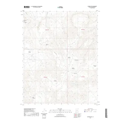
2018 Map of Pastora Peak
USGS Topo · Published 2018About this map
Pastora Peak dominates this high-elevation landscape within the Carrizo Mountains of Apache County, Arizona. The terrain is characterized by a complex drainage system, where intermittent waterways like Tsitah Wash and Tso Tsosic Wash carve through the elevated plateaus of Chezhindeza Mesa and Toh Chin Lini Mesa. These geological features are accessible via a network of tribal routes, including Indian Rte 5043 and Indian Rte 5016, which traverse the high desert floor. Local water sources are noted at Sidehill Spring and Forst Spring, suggesting traditional seasonal utility in an otherwise arid environment. The map captures a section of the Navajo Nation just prior to 2018, illustrating the intersection of ancient geological landforms and modern jurisdictional road designations.
Find a feature on this map
27 named features on this map. Tap any name to fly to it.
Don’t see what you’re looking for? This feature index may not catch every label — zoom into the map to look around manually.
Map Details
Editions of this 2018 Pastora Peak Map
This is the sole edition of this map. No revisions or reprints were ever made.
Other maps of this area

1892 · Canyon De Chelly
USGS Topo · 1:250,000

1953 · Los Gigantes NE
USGS Topo · 1:24,000

1953 · Redrock Valley NE
USGS Topo · 1:24,000

1953 · Pastora Peak SW
USGS Topo · 1:24,000

1953 · Pastora Peak NW
USGS Topo · 1:24,000

1953 · Dinne Mesa NE
USGS Topo · 1:24,000

1953 · Pastora Peak NE
USGS Topo · 1:24,000

1953 · Redrock Valley NW
USGS Topo · 1:24,000

1953 · Dinne Mesa SE
USGS Topo · 1:24,000

1953 · Pastora Peak SE
USGS Topo · 1:24,000