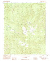
1982 Map of Pastora Peak
USGS Topo · Published 1982About this map
Navajo Indian Reservation land dominates this 1982 provisional survey of Apache County, where the high elevations of the Carrizo Mountains meet a complex network of seasonal washes. The topography is defined by prominent landmarks like Pastora Peak and Zibeted Peak, with the expansive Toh Chin Lini Mesa and Chezhindezza Mesa providing a glimpse into the dramatic plateau landscape. Water sources are critical identifiers in this arid region, marked by numerous named points such as Stop Trail Spring, Redrock Spring, and First Spring. These locations, alongside drainage systems like Blackhorse Creek and Teec Nos Pos Wash, illustrate the traditional land use and environmental constraints of the area. Resource exploration is also evident through several oil wells, drillholes, and prospects scattered across the terrain, reflecting late-twentieth-century industrial interest in this part of Arizona.
Find a feature on this map
19 named features on this map. Tap any name to fly to it.
Don’t see what you’re looking for? This feature index may not catch every label — zoom into the map to look around manually.
Map Details
Editions of this 1982 Pastora Peak Map
This is the sole edition of this map. No revisions or reprints were ever made.
Other maps of this area

1892 · Canyon De Chelly
USGS Topo · 1:250,000

1953 · Los Gigantes NE
USGS Topo · 1:24,000

1953 · Redrock Valley NE
USGS Topo · 1:24,000

1953 · Pastora Peak SW
USGS Topo · 1:24,000

1953 · Pastora Peak NW
USGS Topo · 1:24,000

1953 · Dinne Mesa NE
USGS Topo · 1:24,000

1953 · Pastora Peak NE
USGS Topo · 1:24,000

1953 · Redrock Valley NW
USGS Topo · 1:24,000

1953 · Dinne Mesa SE
USGS Topo · 1:24,000

1953 · Pastora Peak SE
USGS Topo · 1:24,000