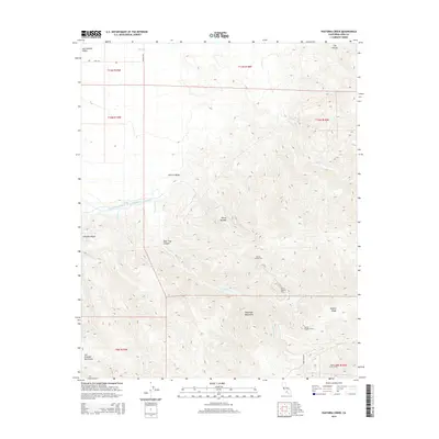
2015 Map of Pastoria Creek
USGS Topo · Published 2015About this map
The Tehachapi Mountains and the San Emigdio Mountains converge in this high-elevation landscape, where massive water infrastructure projects navigate the complex terrain. The Governor Edmund G Brown California Aqueduct is a dominant man-made feature, winding through the Central Valley before entering a series of underground passages. Engineering of the mid-20th century is evident in the alignment of Tunnel Number One, Tunnel Number Two, and Tunnel Number Three, culminating in the significant Carley V Porter Tunnel near the southern boundary. These tunnels represent a critical link in the state's water delivery system, piercing through the rugged slopes of Geghus Ridge. Higher elevations are marked by deep incisions like Liveoak Canyon and Bear Trap Canyon, while the northern reaches open into the San Joaquin Valley, showing the start of agricultural irrigation via the 850 Canal.
Find a feature on this map
27 named features on this map. Tap any name to fly to it.
Don’t see what you’re looking for? This feature index may not catch every label — zoom into the map to look around manually.
Map Details
Editions of this 2015 Pastoria Creek Map
This is the sole edition of this map. No revisions or reprints were ever made.
Other maps of this area

1903 · Tejon
USGS Topo · 1:125,000

1914 · Caliente
USGS Topo · 1:125,000

1931 · West of Tejon Hills
USGS Topo · 1:31,680

1931 · Tejon Hills
USGS Topo · 1:31,680

1933 · Tejon Hills
USGS Topo · 1:31,680
1934 · West of Tejon Hills
USGS Topo · 1:31,680

1942 · Tecuya Creek
USGS Topo · 1:24,000

1942 · Frazier Mountain
USGS Topo · 1:24,000

1943 · Cummings Mountain
USGS Topo · 1:62,500

1943 · Neenach
USGS Topo · 1:62,500