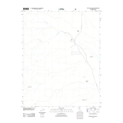
2012 Map of Pat Keyes Canyon
USGS Topo · Published 2012About this map
The Inyo Mountains and the arid expanse of the Saline Valley define this landscape in eastern California. The map documents a rugged transition of elevation where several canyons, including Paiute Canyon, Pat Keyes Canyon, and McElvoy Canyon, descend toward the valley floor. Water sources are critical markers in this desert environment, with the Willow Cr system providing a central drainage point. The existence of Willow Creek Camp suggests a point of human activity or refuge near the confluence of the N Fork Willow Cr and S Fork Willow Cr. Remote access to the area is maintained via the Waucoba Saline Rd and Saline Valley Rd. Further south, the presence of Badwater Springs and Pat Keyes Spring highlights the sparse but vital springs that once supported early travelers and local wildlife.
Find a feature on this map
13 named features on this map. Tap any name to fly to it.
Don’t see what you’re looking for? This feature index may not catch every label — zoom into the map to look around manually.
Map Details
Editions of this 2012 Pat Keyes Canyon Map
This is the sole edition of this map. No revisions or reprints were ever made.
Other maps of this area

1907 · Mt. Whitney
USGS Topo · 1:125,000

1908 · Ballarat
USGS Topo · 1:250,000

1913 · Ballarat
USGS Topo · 1:250,000

1919 · Mt. Whitney
USGS Topo · 1:125,000

1937 · Mt. Whitney
USGS Topo · 1:125,000

1948 · Death Valley
USGS Topo · 1:250,000

1948 · Fresno
USGS Topo · 1:250,000

1950 · New York Butte
USGS Topo · 1:62,500

1951 · New York Butte
USGS Topo · 1:62,500

1951 · Waucoba Wash
USGS Topo · 1:62,500