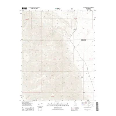
2015 Map of Pat Keyes Canyon
USGS Topo · Published 2015About this map
Pat Keyes Spring sits at the base of the White Inyo Range, marking a critical water source in a landscape defined by extreme elevation changes. This 2015 study covers the high-desert transition where the peaks of the Inyo National Forest descend into the northern reaches of Death Valley National Park. The topography is dominated by steep drainage systems like Pat Keyes Canyon and Paiute Canyon, which funnel seasonal runoff toward the arid floor of Saline Valley. Human presence is sparse, limited to the rugged tracks of Saline Valley Rd and Waucoba Saline Rd. These routes trace the edge of the valley, passing through areas of historical interest such as Badwater Springs. The map reveals the intricate drainage network of Willow Cr and its forks as they carve through the mountain front, providing a detailed record of the desert's natural hydrological features.
Find a feature on this map
21 named features on this map. Tap any name to fly to it.
Don’t see what you’re looking for? This feature index may not catch every label — zoom into the map to look around manually.
Map Details
Editions of this 2015 Pat Keyes Canyon Map
This is the sole edition of this map. No revisions or reprints were ever made.
Other maps of this area

1907 · Mt. Whitney
USGS Topo · 1:125,000

1908 · Ballarat
USGS Topo · 1:250,000

1913 · Ballarat
USGS Topo · 1:250,000

1919 · Mt. Whitney
USGS Topo · 1:125,000

1937 · Mt. Whitney
USGS Topo · 1:125,000

1948 · Death Valley
USGS Topo · 1:250,000

1948 · Fresno
USGS Topo · 1:250,000

1950 · New York Butte
USGS Topo · 1:62,500

1951 · New York Butte
USGS Topo · 1:62,500

1951 · Waucoba Wash
USGS Topo · 1:62,500