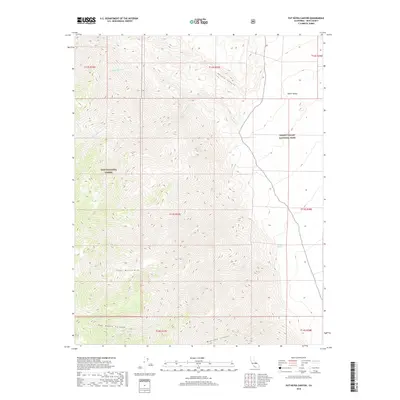
2018 Map of Pat Keyes Canyon
USGS Topo · Published 2018About this map
The Inyo Mountains dominate this high-elevation landscape, where deep drainages and scarce water sources define the geography. This 2018 survey detail shows the convergence of Inyo National Forest and Death Valley National Park, highlighting the extreme relief between the mountain peaks and the floor of the Saline Valley. Critical water points, such as Badwater Springs and Pat Keyes Spring, are recorded along the steep slopes of Pat Keyes Canyon and McElvoy Canyon. The map traces the complex hydrology of the region, including N Fork Willow Cr and S Fork Willow Cr, which merge into Willow Cr as they descend toward the desert basins. For those studying California's high-desert wilderness, the map provides a precise account of the land's natural features and administrative boundaries.
Find a feature on this map
19 named features on this map. Tap any name to fly to it.
Don’t see what you’re looking for? This feature index may not catch every label — zoom into the map to look around manually.
Map Details
Editions of this 2018 Pat Keyes Canyon Map
This is the sole edition of this map. No revisions or reprints were ever made.
Other maps of this area

1907 · Mt. Whitney
USGS Topo · 1:125,000

1908 · Ballarat
USGS Topo · 1:250,000

1913 · Ballarat
USGS Topo · 1:250,000

1919 · Mt. Whitney
USGS Topo · 1:125,000

1937 · Mt. Whitney
USGS Topo · 1:125,000

1948 · Death Valley
USGS Topo · 1:250,000

1948 · Fresno
USGS Topo · 1:250,000

1950 · New York Butte
USGS Topo · 1:62,500

1951 · New York Butte
USGS Topo · 1:62,500

1951 · Waucoba Wash
USGS Topo · 1:62,500