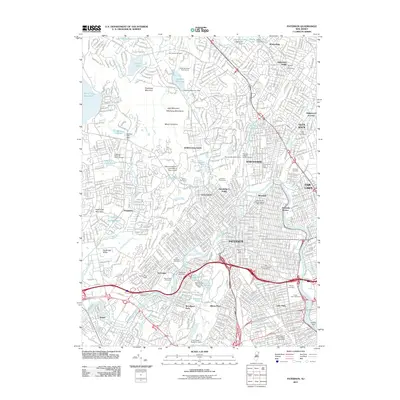
2011 Map of Paterson
USGS Topo · Published 2011About this map
Paterson and its surrounding boroughs are defined by the winding course of the Passaic River and the varied terrain of the Watchung Mountains. This detailed survey of the early twenty-first century highlights a dense suburban and industrial landscape where water management is central, from the Haledon Reservoir to the Great Notch Reservoir Dam. The area's manufacturing heritage is visible in labels like the Barbour Mill Dam, while its diverse social history is reflected in the high concentration of denominational burial grounds, including the Preakness Reformed Dutch Cemetery and the Ahavath Joseph Jewish Cemetery.
Find a feature on this map
80 named features on this map. Tap any name to fly to it.
Don’t see what you’re looking for? This feature index may not catch every label — zoom into the map to look around manually.
Map Details
Editions of this 2011 Paterson Map
This is the sole edition of this map. No revisions or reprints were ever made.
Other maps of this area

1888 · Morristown
USGS Topo · 1:62,500

1888 · Paterson
USGS Topo · 1:62,500

1891 · Greenwood Lake
USGS Topo · 1:62,500

1891 · Ramapo
USGS Topo · 1:62,500

1892 · Paterson
USGS Topo · 1:62,500

1893 · Greenwood Lake
USGS Topo · 1:62,500

1893 · Ramapo
USGS Topo · 1:62,500

1894 · Morristown
USGS Topo · 1:62,500

1898 · Morristown
USGS Topo · 1:62,500

1898 · Paterson
USGS Topo · 1:62,500