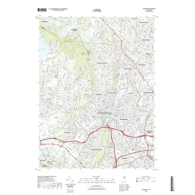
2019 Map of Paterson
USGS Topo · Published 2019About this map
Paterson Great Falls National Historical Park anchors this densely populated landscape, marking the historic industrial heart where the Passaic River drops through the city. The 2019 survey documents the extensive urban grid of Paterson alongside its surrounding boroughs, illustrating a complex built environment defined by historical manufacturing zones and modern educational institutions like William Paterson University and Passaic County Community College.
Find a feature on this map
76 named features on this map. Tap any name to fly to it.
Don’t see what you’re looking for? This feature index may not catch every label — zoom into the map to look around manually.
Map Details
Editions of this 2019 Paterson Map
This is the sole edition of this map. No revisions or reprints were ever made.
Other maps of this area

1888 · Morristown
USGS Topo · 1:62,500

1888 · Paterson
USGS Topo · 1:62,500

1891 · Greenwood Lake
USGS Topo · 1:62,500

1891 · Ramapo
USGS Topo · 1:62,500

1892 · Paterson
USGS Topo · 1:62,500

1893 · Greenwood Lake
USGS Topo · 1:62,500

1893 · Ramapo
USGS Topo · 1:62,500

1894 · Morristown
USGS Topo · 1:62,500

1898 · Morristown
USGS Topo · 1:62,500

1898 · Paterson
USGS Topo · 1:62,500