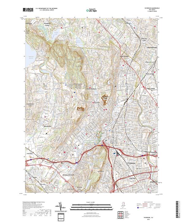
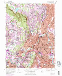
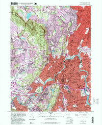
2023 Map of Paterson
USGS Topo · Published 2023About this map
Paterson Great Falls National Historical Park anchors the industrial and geological landscape of this area, where the Passaic River carves through the basalt of the Watchung Mountains. The map reveals an intricate network of urban centers and suburban boroughs, including Paterson, Clifton, and Hawthorne, woven together by major transit corridors like the Garden State Pkwy and the Erie Lackawanna RR. Educational institutions such as William Paterson University of New Jersey and Montclair State University occupy significant acreage alongside preserved open spaces.
Find a feature on this map
84 named features on this map. Tap any name to fly to it.
Don’t see what you’re looking for? This feature index may not catch every label — zoom into the map to look around manually.
Map Details
Editions of this 2023 Paterson Map
This is the sole edition of this map. No revisions or reprints were ever made.
Historical Maps of Totowa Through Time
10 maps found

1888 Paterson
Passaic County, NJ

1892 Paterson
Passaic County, NJ

1898 Paterson
Passaic County, NJ

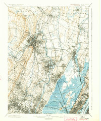
1900 Paterson
Passaic County, NJ
1903 Paterson
Passaic County, NJ
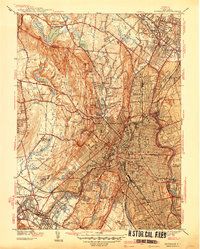
1938 Paterson
Passaic County, NJ
1944 Paterson
Passaic County, NJ
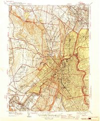
1955 Paterson
Passaic County, NJ
1995 Paterson
Passaic County, NJ
2023 Paterson
Passaic County, NJ