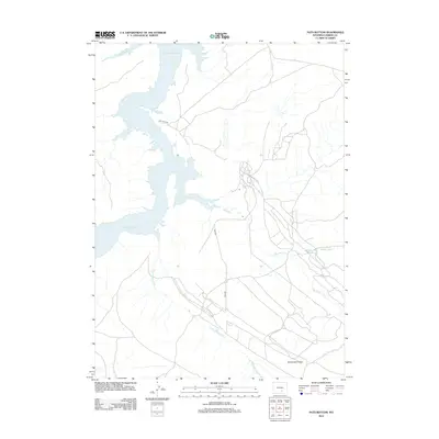
2012 Map of Pats Bottom
USGS Topo · Published 2012About this map
Seminoe Reservoir dominates the western landscape of this Carbon County region, its winding shoreline and intricate inlets shaped by the rugged elevation of the high plains. The map reveals an intensive system of water management critical to this arid Wyoming environment, featuring the long courses of Big Ditch and Saint Marys Ditch as they navigate the terrain. To the south, the prominent uplift of Monument Ridge provides a significant geographic anchor, while smaller water features like Steel-Granary Reservoir and the Middle Ditch indicate the dispersed nature of local ranching and irrigation infrastructure. Transportation is primarily defined by unpaved corridors such as Cdk Point Rd and Arch Rd, reflecting the area's utility for resource management and rural access.
Find a feature on this map
8 named features on this map. Tap any name to fly to it.
Don’t see what you’re looking for? This feature index may not catch every label — zoom into the map to look around manually.
Map Details
Editions of this 2012 Pats Bottom Map
This is the sole edition of this map. No revisions or reprints were ever made.
Other maps of this area

1893 · Fort Steele
USGS Topo · 1:125,000

1914 · Hanna
USGS Topo · 1:62,500

1914 · Walcott
USGS Topo · 1:62,500

1953 · Seminoe Dam SW
USGS Topo · 1:24,000

1953 · Seminoe Dam SE
USGS Topo · 1:24,000

1953 · Schneider Ridge
USGS Topo · 1:24,000

1954 · Rawlins
USGS Topo · 1:250,000

1955 · Casper
USGS Topo · 1:250,000

1958 · Rawlins
USGS Topo · 1:250,000

1958 · Casper
USGS Topo · 1:250,000