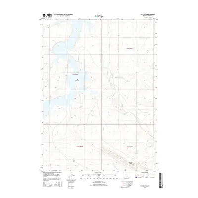
2015 Map of Pats Bottom
USGS Topo · Published 2015About this map
Seminoe Reservoir dominates the western landscape of this Carbon County region, where the water's edge meets a complex system of irrigation infrastructure. This network of gravity-fed water management is clearly defined by the paths of the North Ditch, Big Ditch, Middle Ditch, and Saint Marys Ditch, which trace the contours of the high desert terrain. The area is anchored by the namesake Pats Bottom near the reservoir's eastern shore, while the southern portion of the quadrangle rises toward the prominent elevations of Edson Ridge and Monument Ridge. This 2015 survey illustrates how the local geography remains shaped by water rights and ranching access, with Cok Point Rd providing one of the few named transport corridors through the open range.
Find a feature on this map
13 named features on this map. Tap any name to fly to it.
Don’t see what you’re looking for? This feature index may not catch every label — zoom into the map to look around manually.
Map Details
Editions of this 2015 Pats Bottom Map
This is the sole edition of this map. No revisions or reprints were ever made.
Other maps of this area

1893 · Fort Steele
USGS Topo · 1:125,000

1914 · Hanna
USGS Topo · 1:62,500

1914 · Walcott
USGS Topo · 1:62,500

1953 · Seminoe Dam SW
USGS Topo · 1:24,000

1953 · Seminoe Dam SE
USGS Topo · 1:24,000

1953 · Schneider Ridge
USGS Topo · 1:24,000

1954 · Rawlins
USGS Topo · 1:250,000

1955 · Casper
USGS Topo · 1:250,000

1958 · Rawlins
USGS Topo · 1:250,000

1958 · Casper
USGS Topo · 1:250,000