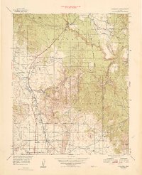
1949 Map of Paulden
USGS Topo · Published 1949About this map
Drake sits as a critical rail junction where the Atchison Topeka and Santa Fe railroad meets the rugged terrain of the Prescott National Forest. This 1949 survey captures the ranching and industrial character of the Chino Valley region just after the war, showing the network of family holdings such as Stewart Ranch Hdqtrs, Del Rio Ranch, and Hubbel Ranch. The Verde River and its tributaries, including Hell Canyon and Big Chino Wash, dictate the placement of early infrastructure like Wagon Tire Dam and Sullivan Lake. Evidence of early territorial industry is found at the United States Mine near St Mathews Mtn, while the Cedar Glade Ranger Sta marks the administrative presence of the Forest Service in managing these high desert lands.
Find a feature on this map
43 named features on this map. Tap any name to fly to it.
Don’t see what you’re looking for? This feature index may not catch every label — zoom into the map to look around manually.
Map Details
Editions of this 1949 Paulden Map
This is the sole edition of this map. No revisions or reprints were ever made.
Other maps of this area

1886 · Chino
USGS Topo · 1:250,000

1887 · Prescott
USGS Topo · 1:250,000

1891 · Chino
USGS Topo · 1:250,000

1892 · Prescott
USGS Topo · 1:250,000

1905 · Jerome
USGS Topo · 1:125,000

1922 · Williams
USGS Topo · 1:125,000

1944 · Clarkdale
USGS Topo · 1:48,000

1944 · Mingus Mountain
USGS Topo · 1:62,500

1947 · Mingus Mtn
USGS Topo · 1:62,500

1947 · Ash Fork
USGS Topo · 1:62,500