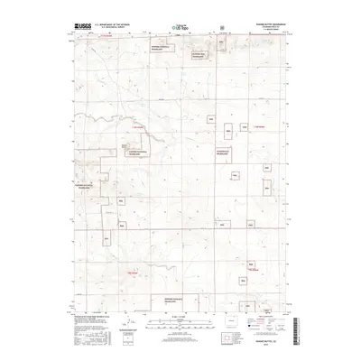
2016 Map of Pawnee Buttes
USGS Topo · Published 2016About this map
Pawnee Buttes rise as a singular landmark amidst the expansive landscape of the Pawnee National Grassland in Weld County. This high-plains environment is defined by its subtle drainage networks and isolated water sources, essential for both early ranching and local ecology. Named features like Elizabeth Spring, De Moss Spring, Reisburg Spring, and The Wolf Spring indicate the critical locations where groundwater reaches the surface. The map traces the winding paths of ephemeral waterways, including N Pawnee Cr and Igo Cr, which carve through the terrain. A sparse grid of county roads, such as Co RD 382 and Co RD 118, provides the only modern infrastructure in a region that remains largely defined by its township-and-range survey boundaries and public conservation lands.
Find a feature on this map
23 named features on this map. Tap any name to fly to it.
Don’t see what you’re looking for? This feature index may not catch every label — zoom into the map to look around manually.
Map Details
Editions of this 2016 Pawnee Buttes Map
This is the sole edition of this map. No revisions or reprints were ever made.
Other maps of this area

1954 · Sterling
USGS Topo · 1:250,000

1954 · Greeley
USGS Topo · 1:250,000

1957 · Greeley
USGS Topo · 1:250,000

1958 · Greeley
USGS Topo · 1:250,000

1958 · Sterling
USGS Topo · 1:250,000

1961 · Greeley
USGS Topo · 1:250,000

1964 · Greeley
USGS Topo · 1:250,000

1965 · Greeley
USGS Topo · 1:250,000
1972 · Keota
USGS Topo · 1:24,000
1972 · Grover SE
USGS Topo · 1:24,000